The new interchange at I-35 and Lone Elm Road partially opened today (the Lone Elm Road and 159th Street bridges over I-35 opened; the ramps to and from I-35 are not open yet), and I got some pictures of the new bike lanes at the interchange.
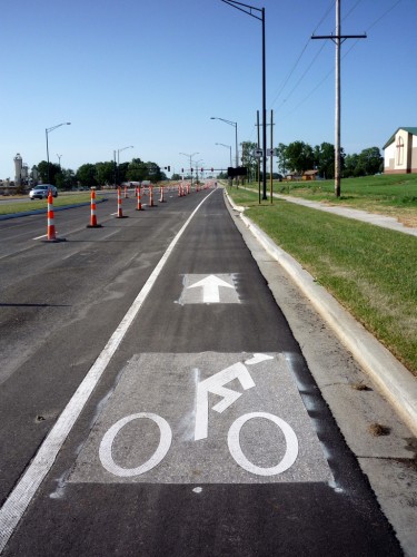
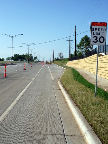
Here’s the view looking north towards the new interchange. At this point, the road is asphalt with a concrete curb and a narrow sidewalk.
This is the first intersection headed north. The road to the right is a church parking lot. The road to the left is the off-ramp leading from northbound I-35, and the on-ramp leading to northbound I-35. The bike lane continues straight through this intersection, with potential conflicts between cyclists continuing straight in the bike lane, and motorists turning right.
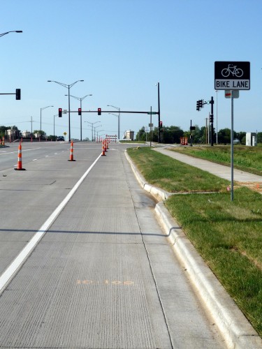
This is the next intersection headed north, at 159th and Lone Elm. Again, there are potential conflicts between cyclists continuing straight in the bike lane, and motorists turning right.
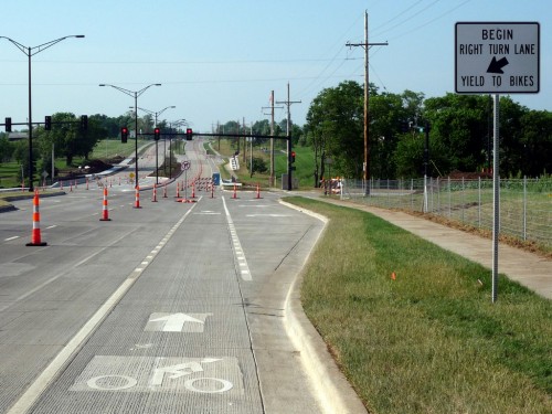
After proceeding up and over the bridge, you come to this intersection. The roads to the right lead to and from southbound I-35. Here, the bike lane becomes a dashed line, indication where motorists should cross the bike and to get to the dedicated right turn lane. There’s also a “Yield to Bikes” sign. Nice. (But will drivers respect it?)
Continuing north, the next intersection is similar, in that there’s a dedicated right turn lane and dashed bike lines. But here there’s no “Yield to Bikes” sign. Why?
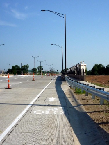
Now we’ve crossed the street and we’re looking south. This is the approach to the bridge on Lone Elm over I-35. Note the wide separated pedestrian path on the right. On the other side of the bridge (northbound) the pathway is narrower; not sure why they’re different.
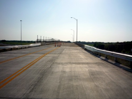
This is a view westbound over the new 159th Street bridge over I-35. This road has no bike lanes (though it looks wide enough to accommodate them). There is a pedestrian path on only one side of the bridge.
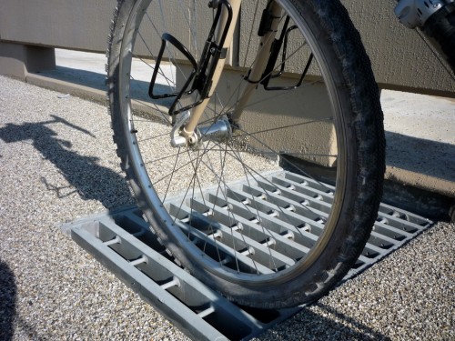
This is one of the grates on the 159th Street bridge. It’s not exactly a wheel-swallower, but if your tire gets into one of the groves and you try to change direction, it could throw you. It seems like it would have worked better with the grid running the other direction…
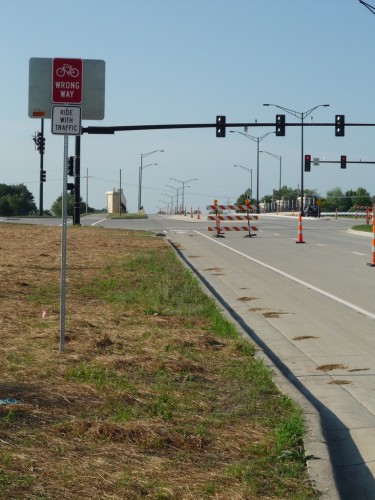
This is looking back north towards 159th and Lone Elm from the southbound bike lane. Two things to note here:
- The wide pedestrian sidepath has dead-ended after crossing 159th via the crosswalk. Not sure what is intended here…
- There’s a “Wrong Way – Ride With Traffic” sign targeted towards cyclists who don’t understand they’re riding on the wrong side of the road (the other side of the sign says “Bike Lane”). This is a nice touch!
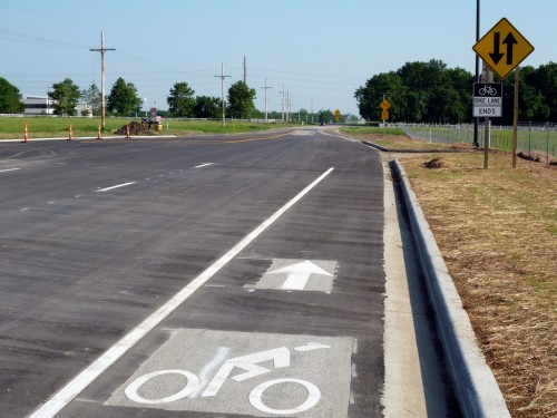
And finally, this is the end of the southbound bike lane. Past this point the road reverts to a standard rural two-lane road with gravel shoulders. There are not one but two “Share The Road” signs. You’ll also note that where the bike lane begins on the other side of the street, there’s another one of those “wrong way” signs for any cyclists who’ve managed to ride all this way on the wrong side of the street.
Construction started on this interchange project in 2008, but it had been in the planning stages for years before that. The inclusion of bike/ped facilities was a hot topic, with much advocacy from local cyclists required to procure, in particular, bike lanes on this crucial corridor.
Much thanks goes to Dale Crawford and the Johnson County Bicycle Club who spearheaded and organized this effort. Without their involvement, this project would have turned Lone Elm into another dangerous arterial road. You can read some of the history of this effort at MoBikeFed.org
See also: New Olathe interchange starts opening today and New Lone Elm/I-35 interchange nearly completed in Olathe. You can also visit the City of Olathe’s project web site for details about the project, including drawings and documents.
Post tags: Bike Lanes, Olathe

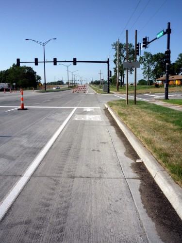


In my opinion the intersection at the church is designed correctly. Cars are expected to yield to through traffic in the bike lane just as they are expected to yield to pedestrians in the crosswalk. The only improvement that might be appropriate is to make the last couple feet of the bike lane a dashed line.
The “right turn yield to bikes” is only meant for intersections where a right turn lane crosses the bike lane. This is also designed correctly with the “bike slot” that allows the bike to continue straight while cars yield before crossing into the turn lane.
Nice reporting!
Here’s my understanding of the questions you’ve raised:
1. On intersections without dedicated right turn lane (2nd & 3rd photos), the bike lane typically extends to the stop bar for all lanes. If there is anything that could be done to improve these, possibly it would be adding a sign on the signal cross arm or pole saying “Right turning vehicles yield to bicycles”. But from the photos this appears to be straight out of AASHTO.
2. On intersections with dedicated right-turn lanes (4th & 5th photos), the striping is correct. They should be signed consistently, however, with a yield to bikes sign at each occurrence where motorists must cross a bike lane to use the right turn lane as you stated. This would be worth noting to the project engineer. The one without the sign is still coned-off so maybe they’re not finished.
3. The wide sidewalk on the west side is to accommodate a future trail connection between Cedar Lake Park and Lone Elm Park, which in turn will ultimately connect to a future Cedar Creek Trail running north from Cedar Lake, through Lake Olathe to the Kansas River. The sidewalk on the east side is a regular width sidewalk. It’s hard to tell from the photos, but all the sidewalk work may not be done at this point. The wide sidewalk ending at the off-ramp intersection may be its temporary ending point until it can be extended further south to Lone Elm Park with the next road widening to 167th Street (if and when that happens). I’m guessing they had to end it here or in the grass at the southern terminus of the project a couple of hundred feet further south.
4. Sidewalks on both sides of 159th Street bridge was a lost battle in the design. Not much can be done about that now. There are still engineers that only walk from their house to the car in the garage and the parking lot to their office and thus cannot grasp why pedestrians need to be on both sides of road even if it is in a major growth area with hundreds of millions of dollars expected to be spent building up the area because of the new interchange, per the Mayor.
5. There are no bike lanes on the 159th Street bridge because they are not on Olathe’s transportation plan. Of course Olathe has not adopted or even acted on the almost 3-year old draft bicycle transportation plan, which is what really needs to be pushed. I can’t recall if 159th is targeted for bike lanes on the draft plan or not. It would make sense if it was as its 2 miles south of 143rd/Dennis and 2 miles north of 175th and the draft bike plan attempted to identify bike lanes every two miles.
6. I’ll have to look at those grates, too. I was assured they would be “bicycle-friendly” grates. If they’re really not, but are called as such, then the issue needs to be raised. The reason the large bars are turned the way they are is the grate functions better as a storm grate with the large bars horizontal to the flow of water. However, I think there are better grates with “vanes” perpendicular to the water flow that provide a safer bicycle design without loosing much in flow capacity. One of the other issues that comes into play in grate selection is weight loading and clogging. I’m sure these are designed for maximum vehicle weight. The “vaned” grates I’m thinking of may not have as high a design loading as the bars are thinner steel and sense the perpendicular bars are closer together, they are more prone to get clogged by debris.
7. The “wrong way bike” signs are supposed to be on the back of the first sign from a street intersection if you were to go in the wrong direction in the bike lane. I’ve also seen a sign telling pedestrians to walk on the left and to yield to bikes in bike lane, but those are generally in much higher density areas than here where bike-ped conflicts are an issue.
It’s nice to see the pavement milled down slightly for the bike lane icons and stripping. They’ll last much longer and not get peeled off next winter by the snow plows, like on Woodland Road.
Thanks for the detailed response, Dale. Excellent.
Interestingly, as I was getting these photos, I came across one pedestrian (jogging in the bike lane) and one cyclist (riding against the flow of traffic on the sidewalk, even though there was a coned-off bike lane and almost no vehicular traffic).
But it was good to see the new facilities getting some use already!